Rundle
North EastNortheast Calgary
The Rundle CTrain station is the neighbourhood's most useful feature — a Blue Line stop that puts downtown within reach and gives the surrounding streets a transit-oriented pulse. On the commercial strips, the draw is the food: a range of kitchens reflecting the northeast's layered settlement history, leaning toward the kinds of places that fill up on weeknights. Families anchor the residential blocks, with Rundle School, St. Rupert School, and Cecil Swanson School close enough that school-hour traffic marks its own daily rhythm. RUNDLE off-leash park fills up in the evenings, and King of Glory Lutheran Church marks the kind of rooted institutional presence that builds quietly over decades. Transit routes spread in every direction from here — east toward Pineridge, north along the corridor, south to Chinook — which makes Rundle feel less like an endpoint and more like a place people move through and then stay.
Census 2021
The Vibe
Top Species
ASH, GREEN (491)SPRUCE, COLORADO (344)SPRUCE, COLORADO BLUE (264)CHOKECHERRY, SCHUBERT (173)POPLAR, NORTHWEST (146)27 Parks
Bike Pathways
Schools your address is assigned to attend
Located here but may serve other attendance areas

Restaurants
- Dairy Queen Grill & Chill3.6 ★(587)
Cafes
Bars & Pubs
- Glenn's Job Site 1 Sports Bar4 ★(119)
- Summit Pub4.5 ★(33)
- Chandu chiman
Bakeries
Groceries
- Eden Grocery and Halal Meat4.1 ★(26)
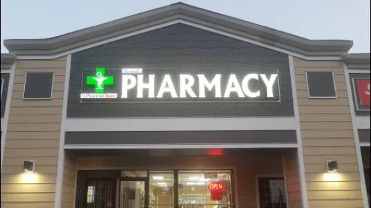
Pharmacies
- Rundle Pharmacy & Travel Clinic, TB Test Clinic4.5 ★(197)
- Cornerstone Pharmasave4.9 ★(31)
- Hope Medicare Pharmacy2.7 ★(13)
- Pharmasave
Shopping
More in the Area
Childcare
Dentists
Places of Worship
- Cornerstone Church4.9 ★(14)
- Shalom fellowship church5 ★(2)
- The Edge HC4 ★(1)
Landmarks
The Economy
Community Assessed Values
North East District Benchmarks2026-03-01
A home costs 12.8x the average income (city avg: 11.2x). Less affordable than the city average.
Average rent is 47% of household income. Above the 30% affordability threshold.
Development Pipeline
Top Business Types
The Infrastructure
Crime Breakdown
Disorder Breakdown
8-Quarter Trend
Quarterly Crime Trend
Quarterly incident counts
Quarterly Disorder Trend
Quarterly incident counts
Top 311 Complaints
Key Routes
- Route 23→
- Route 34→
- Route 38→
- Route 43→
- Route 48→
Bike Infrastructure
Top Categories
24-Month Trend
Never miss new data
Get the monthly digest delivered to your inbox.